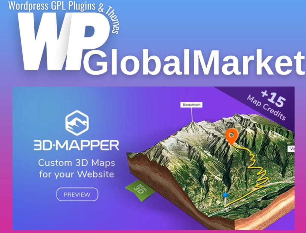
3D Map WordPress Plugin – 3D-Mapper
100% Original Content
All our products are 100% original and obtained directly from the respective developers. We do not modify, alter, or inject any code, ensuring you receive authentic, untouched premium files for your professional projects.
Safe & Secure Files
Your security is our top priority. Every file in our library is scanned daily using advanced premium security tools to guarantee they are 100% free from malware, viruses, or hidden scripts that could harm your website.
Lifetime Updates
Never worry about your website becoming outdated. Once you purchase, you receive access to all future versions and updates. You can easily track and download new releases directly from your personal dashboard.
GPL Licensed & Legal
All items are distributed under the General Public License (GPL). This provides you the legal freedom to use these official products on as many websites as you wish without any restricted domains or limitations.
Product Description
The 3D-Mapper WordPress plugin is a powerful tool for adding dynamic, interactive 3D maps to WordPress websites. Here is a summary of its key features and functionalities:
Plugin Overview:
- Purpose: To create and embed custom 3D maps on WordPress sites without the need for coding.
- Ease of Use: Designed for both beginners and experienced web designers.
- Integration: Supports multiple map tile sets like OpenStreetMap, OpenTopoMap, Outdoor, Satellite, and more.
- Customization: Offers extensive settings for map editing, including height, rotation, markers, water levels, lighting, textures, and skybox options.
Usage Guide:
- Installation:
- Download the plugin from Codecanyon.
- Upload and install it within the WordPress dashboard.
- Adding 3D Maps:
- Import sessions or personal images.
- Customize the map as per specific requirements.
- Shortcode Integration:
- Utilize a shortcode to incorporate the map into your website.
Notable Features:
- Search Options: Various search functionalities available within the maps.
- GPX File Import: Supports importing .gpx and .kml files.
- Editor Tools: Allows adjustments for map height, rotation, markers, textures, skybox settings, and more.
- Free Map Credits: Includes 15 map credits for creating custom 3D maps on 3D-Mapper.com.
WordPress Plugin Features:
- Ease of Import: One-click import for maps.
- Customization: Edit map features directly within WordPress.
- Texture Options: Use high-res textures, set canvas size, transparent backgrounds, background images/colors, overlays, and more.
- Embedding: Easily embed maps using shortcodes.
Additional Applications:
- 3D File Export: Download maps as glTF files for use in other 3D applications like Blender or Unreal Engine.
- 3D Printing: Export as STL or OBJ files for 3D printing purposes.
Pre-Sale Considerations:
- Data Source: Maps utilize digital terrain models without buildings displayed as elevation.
- Usage of Maps: Terms of Use regarding the use of map data, attributions required for map material usage, and conditions for using data sets from 3D-Mapper's location browser.
The plugin aims to offer an intuitive interface for creating and integrating captivating, interactive 3D maps into WordPress sites, allowing users to enhance their website's visual experience and engagement.
Best-Selling Products
View All